Overview drone shot of Three Creeks Farm Mitigation Site in the Yadkin Pee Dee river basin in Davidson County, North Carolina by Eco Terra - Featured Photo

Three Creeks Farm

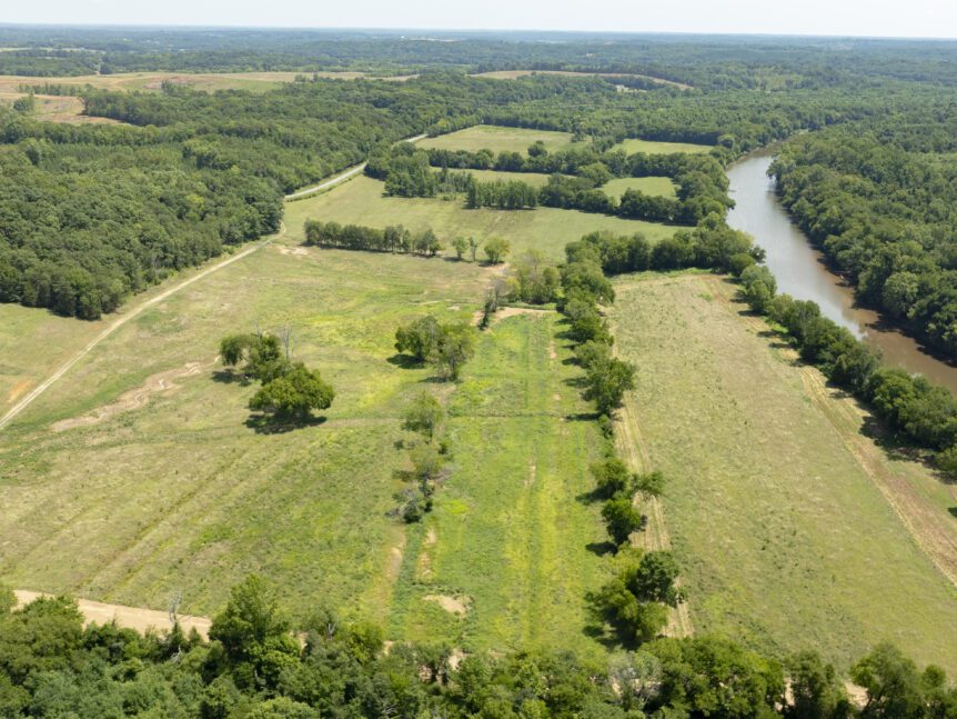
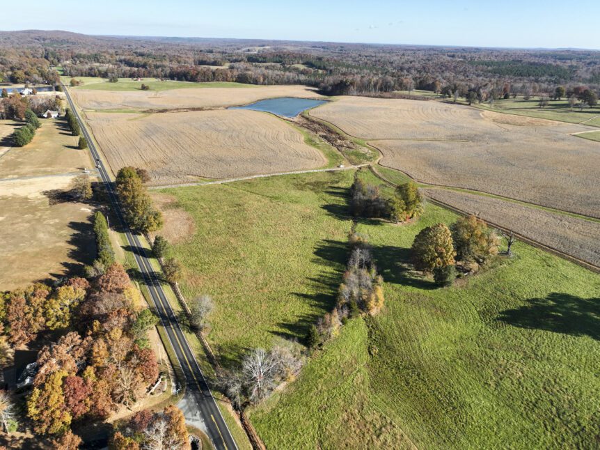
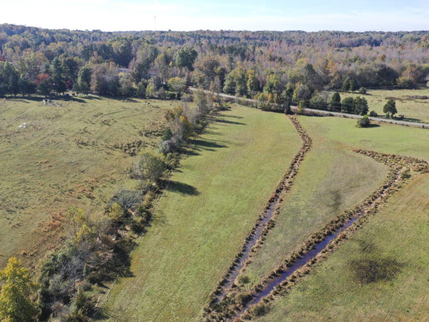
Three Creeks FarmAbout The Three Creeks Farm site is in Davidson County near the community of Midway and within the Yadkin River Basin. The project includes the restoration and enhancement of five stream channels as well as the restoration and preservation of riparian wetlands in the Abbotts Creek watershed. All stream channels and wetlands have been impacted by hay production, …

Drone cover image for Eco Terra's mitigation project, Sweet Potato

Sweet Potato

Sweet PotatoAbout The Sweet Potato Mitigation Site (Site) is a nutrient offset and riparian buffer restoration site located approximately 8 miles west of Mt. Olive north of Highway 55 in Wayne County. The Nutrient Offset & Buffer Mitigation Plan (NOBMP) is under development and has been submitted under the Terra 2023 Neuse 01 Umbrella Mitigation Banking Instrument (UMBI) to the …

Aerial image of New Farm Mitigation Site in the Neuse river basin in North Carolina for Eco Terra

New Farm

New FarmAbout The New Farm Mitigation Site (Site) is a nutrient offset and riparian buffer restoration site located approximately 8 miles west of Mt. Olive north of Highway 55 in Wayne County. The Nutrient Offset & Buffer Mitigation Plan (NOBMP) is under development and has been submitted under the Terra 2023 Neuse 01 Umbrella Mitigation Banking Instrument (UMBI) to the …

Overview drone image of Mushroom Meadow Stream and Wetland Mitigation Site in Milton, North Carolina in RO-04 river basin by Eco Terra

Mushroom Meadow

Mushroom MeadowMushroom Meadow About The Mushroom Meadow Stream and Wetland Mitigation Site in Caswell County, approximately 2.0 miles east of Milton off River Bend Road, and is within the Roanoke River Basin. The project will include the restoration of streams and riparian wetlands within the greater Dan River watershed and provide both ecological and water quality benefits within the Roanoke …

Overview drone image of Mill Creek Mitigation Bank in Hiwassee, GA in TN-02 river basin by Eco Terra

Mill Creek

Mill CreekAbout Eco Terra has entered into a contract to place an easement on a property that would comprise the Mill Creek Stream Mitigation Site (MCSMS) in Towns County, approximately 5.25 miles south of Hiawassee, Georgia (Figure 1). The MCSMS is within the Owl Creek – Hiawassee River 12-digit HUC 060200020102 within the Tennessee River Basin. The mitigation area is …

Drone cover image for Eco Terra's mitigation project, Little Timber.

Little Timber

Little TimberAbout Little Timber Mitigation Site (Site) is a nutrient offset and riparian buffer restoration site located approximately 4 miles west of the Dudley off of Oberry Road in Wayne County. The Nutrient Offset & Buffer Mitigation Plan (NOBMP) is under development and has been submitted under the Terra 2023 Neuse 01 Umbrella Mitigation Banking Instrument (UMBI) to the NC …

Lakey Creek

Lakey CreekAbout The Lakey Creek Mitigation Site is in Macon County, approximately eight miles northwest of the Town of Franklin, and is within the Little Tennessee River Basin. The project will include the restoration and enhancement of sixstream channels in the Cowee Creek watershed and restoration of wetland areas. The project will result in both ecological and water quality benefits …

Aerial image of Horseshoe Mitigation Site in the Neuse river basin in North Carolina for Eco Terra

Horseshoe

HorseshoeAbout The Horseshoe Mitigation Site (Site) is a nutrient offset and riparian buffer restoration site located approximately 4 miles west of Mt. Olive north of State Highway 55 in Wayne County. The Nutrient Offset & Buffer Mitigation Plan (NOBMP) is under development and has been submitted under the Terra 2023 Neuse 01 Umbrella Mitigation Banking Instrument (UMBI) to the NC …

Overview drone shot of Bonsai Mitigation Site in the Tar-Pamlico river basin in Edgecombe County, North Carolina by Eco Terra - Featured Photo

Bonsai

Bonsai Mitigation SiteAbout Bonsai Mitigation site is a riparian buffer mitigation and nutrient offset Site located in Edgecombe County approximately 7 miles northeast of Rocky Mount off of Battleboro-Leggett Road. The Nutrient Offset & Buffer Mitigation Plan (NOBMP) was submitted under the Bonsai Tar-Pamlico Umbrella Mitigation Banking Instrument (UMBI) to the NC Division of Water Resources (DWR) in 2024. The …

Drone overview shot of our mitigation bank project in Durham County, North Carolina, Alder Valley - Eco Terra

Alder Valley

Alder ValleyAbout Alder Valley Mitigation Site is located in northern Durham County, NC and will have streams and riparian buffers restored within the Flat River watershed as well as wetland restoration and nutrient offset. There are four different unnamed tributaries with an existing pond called McFarland Lake which will be drained. The site features an existing pond with eroded banks …